Sky-Alert: Why 2025 is Shaping Up to Be a Landmark Year in Weather
As we move deeper into 2025, it’s increasingly clear that this year is not just another page in the calendar — it may well become a turning point in how we understand and experience weather. From blistering heat to violent rainfall, from melting ice to deep-freeze cold snaps, the indicators are mounting. In this article I’ll walk you through why 2025 is shaping up to be a landmark year in weather, exploring the trends, the signals, the impacts, and what it means for the future.
- Global heat-records and a new thermal regime
One of the most striking signals for 2025 is that global temperatures are continuing their upward march. According to the World Meteorological Organization (WMO), 2025 is likely to be among the three warmest years on record, following 2023 and 2024.
Why is this significant?
- When the baseline itself rises, “normal weather” shifts. What used to be extreme becomes closer to typical.
- Warmer air holds more moisture, which can fuel heavier rainfall and more intense storms. For each additional °C of warming, the atmosphere can hold roughly 7 % more water vapour.
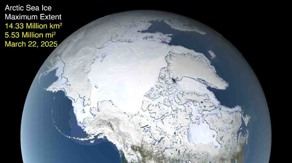
- Arctic regions are warming at an even faster rate — the WMO projects the Arctic may warm more than three times the global average in the coming years.
Thus 2025 is less about a “hot year” and more about entering a new regime where the early thresholds of what’s dangerous are being crossed.
- More extreme rainfall, shifting patterns and “weather whiplash”
Another big theme of 2025: weather isn’t just getting hotter — it’s getting wilder and more uneven.
For example, in India, the India Meteorological Department (IMD) projects above-average monsoon rainfall of about 105 % of the long-term average for 2025. The Economic Times Simultaneously, other reports show some regions experiencing historically cool periods (e.g., May 2025 in India was “one of the coldest Mays in nearly a century”).
Globally, a study highlighted “climate whiplash” in major cities worldwide — abrupt swings from dry to wet, or vice versa.
Key takeaways:
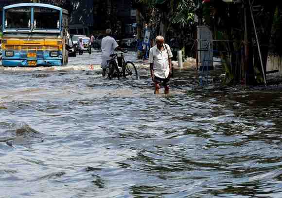
- Regions are seeing heavier downpours but fewer rainy days — meaning more rain in less time, which increases flood risk and overwhelms infrastructure.
- Some areas that traditionally got abundant rainfall are seeing less — dryness creeping in even while global averages rise.
- Because weather is more variable, planning becomes harder: agriculture, infrastructure, water resources—all are stressed.
Thus 2025 isn’t just “hot” — it’s irregular, unexpected, and volatile.
- Heatwaves, cold snaps and the “new normals”
It might seem contradictory: a hot year and a cold snap year. But that’s exactly the paradox of 2025.
- The 2025 India-Pakistan heat wave started earlier than usual and pushed temperatures very high in April–June.
- Conversely, some regions recorded unusually cool spells: for instance, as noted, May in parts of India was significantly cooler than usual.
- Studies show that what were once “once-in-a-century” events (cold waves, storms, heatwaves) are happening more frequently.
What this means:
- The term “normal weather” is rapidly losing meaning. The extremes are becoming part of the standard deviation.
- Infrastructure and societies built for the old normal may struggle: heat shelters, cooling systems, winter preparedness, drainage systems—they all face new stress.
- Vulnerable populations (elderly, outdoor workers, agricultural labourers) are increasingly at risk from multiple kinds of extremes, not just heat.
- Oceans, ice-melt and cascading effects
In the background of all this weather is the ocean and cryosphere system — the seas and the ice — whose dynamics strongly influence weather patterns.
- Warmer oceans lead to more evaporation, which fuels moisture in the atmosphere and thus heavier rainfall events.
- The Arctic warming more rapidly means ice-cover is shrinking faster, which affects jet streams, polar vortex stability, and thus mid-latitude weather patterns (cold snaps, storms) in ways that are still being understood.
- Sea-level rise and expansion from warm water contribute to coastal flooding and salt-water intrusion, which tie into extreme weather by making storms more damaging.
In short: no part of the climate–weather system is disconnected. 2025 shows how underlying changes (in oceans/ice) are manifesting as surface weather extremes.
- Why 2025 may be the marker year
So far I’ve pointed to many individual strands — heat, rainfall, variability, oceans, extremes. But why call 2025 a landmark year?
- Thresholds being breached: The fact that 2025 is likely among the warmest on record means we are getting dangerously close to or beyond thresholds (for example, 1.5 °C above pre-industrial levels) that scientists have warned about.
- Compound stresses: More frequent simultaneous extremes (heat + rain + storm surge + flooding) mean that the combined effects will be larger than the sum of the parts.
- Infrastructure and societal lag: Many regions are still adapting to the “old” extremes. 2025 may be the year when adaptation gaps show up starkly—hospitals, roads, agriculture, cities may all reach a breaking point.
- Psychological shift: After a decade (or more) of incremental change, 2025 may be the year when weather is seen not only as “a natural process changed by humans” but as something systematically different. A wake-up call moment.
- Policy inflection: Because the signals are so strong, 2025 could influence climate policy, public investment, insurance, urban planning, and the global narrative around weather/climate resilience.
In sum: 2025 is not just another hot year — it may mark the beginning of a new climate-weather era.
- What this means for India (and Tamil Nadu region)
Since you’re located in Tamil Nadu/India, here are some region-specific implications:
- The Indian monsoon in 2025 is projected to be above average (105 % of long-term average) according to IMD projections.
- But even with above-average rainfall, the distribution matters — some parts may receive much more, others much less. The risk of flooding in coastal zones, landslides in hilly regions, and shifts in agriculture cycles increases.
- In Tamil Nadu and neighbouring areas, warmer seas (Bay of Bengal / Indian Ocean) can increase the intensity of cyclones or heavy rainfall events.
- Heatwaves remain a serious risk, especially for outdoor labourers, farms, informal settlements—with rising baseline temperatures making “safe limits” harder to maintain.
- Infrastructure—drainage, urban heat mitigation, agricultural planning—will need to factor in more variability (more dry spells, more intense rainfall, perhaps even unexpected cooler periods).
- This may be a good year to revisit disaster preparedness: early warning systems, community awareness, resilient agriculture (drought/heat resistant crops), cooling shelters, improved drainage.
- How to prepare for the new weather forecast reality
Given that 2025 is shaping up so dramatically, here are some practical steps (for individuals, communities, planners) to adapt:
For individuals & households:
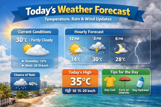
- Stay informed: follow local forecasts and warnings (e.g., for heatwaves, heavy rains, storms).
- Heat safety: Ensure households have access to cooling or shade, adequate hydration; vulnerable persons (children, elderly) especially need attention.
- Flood / rainfall: Have contingency plans for heavy rains—clean drain pathways, secure valuables, consider checking insurance or local home risk.
- Health: Note that more heat + humidity may lead to increased vector-borne disease risk, heat-stress and dehydration episodes.
- For agricultural/farming households: Consider crop varieties resilient to heat/rain variability, check soil moisture, diversify where possible.
For communities & planners:
- Infrastructure audit: Are drainage systems able to handle intense rainfall bursts? Are cooling centres available?
- Urban planning: Increase green cover, reduce heat islands, ensure building codes take into account higher heat/rain extremes.
- Early warning and communication: Strengthen flood/heat alerts, community response systems.
- Agriculture & water: Diversify water sources, improve storage, ensure water management is flexible for both heavy rains and dry spells.
- Insurance & risk: Encourage flexible risk-management systems (for example, crop insurance that factors in variability, not just fixed norms).
- The bigger picture: weather meets climate
It’s important to emphasise that while we talk about “weather in 2025”, the underlying driver is longer-term climate change. But what makes 2025 special is how the two are meeting:
- The climate baseline is shifting (higher average temperatures, altered ocean/atmosphere dynamics).
- The weather extremes are becoming more frequent/intense because of that shift.
- Thus, 2025 is where the climate change influence becomes undeniably visible in everyday weather — storms, floods, heatwaves, cold snaps.
- Policymakers, planners, and the public can no longer treat extreme weather as “once in a while” — they must treat it as a new normal.
Final thoughts
2025 is shaping up to be a landmark year for weather — not because every region will break records in the same way, but because we’re seeing the fundamental patterns change: higher temperatures, more volatility, tighter coupling between ocean/atmosphere/ice, shifting rainfall patterns, and infrastructure being challenged. For countries like India, and regions like Tamil Nadu, it’s a call to wake up and adapt.